Property Record
5558 Suwanee Dam Rd, Sugar Hill, GA 30518
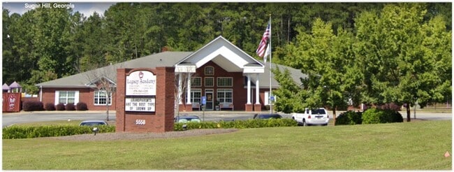

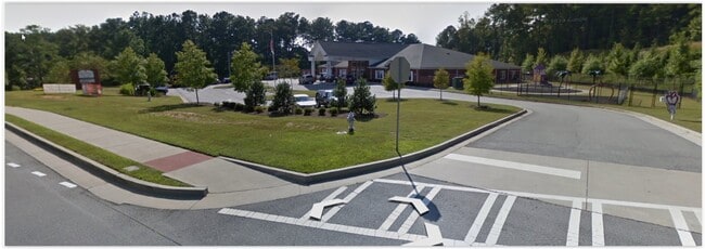
This Property Is For Sale
Property Detail
5558 Suwanee Dam Rd
7-318-047
SUWANEE DAM RD
Daycare
GWINNETT
OI
Georgia
B and X Area of moderate flood hazard, usually the area between the limits of the 100-year and 500-year floods.
318
2025
2.65 AC
2025
Suwanee/Buford
050116
Atlanta
12,136 SF
Atlanta-Sandy Springs-Roswell, GA
NEARBY LISTINGS FOR SALE OR LEASE
-
-
View all Sugar Hill listings for sale on LoopNet.com
DEMOGRAPHICS near 5558 Suwanee Dam Rd
1 mile
3 mile
5 mile
2025 Total Population
6,796
59,011
157,185
2030 Population
7,073
62,388
166,922
Pop Growth 2025-2030
+ 4.08%
+ 5.72%
+ 6.19%
Average Age
39
38
38
2025 Total Households
2,112
18,541
50,341
HH Growth 2025-2030
+ 4.26%
+ 5.80%
+ 6.27%
Median Household Inc
$141,147
$131,752
$130,210
Avg Household Size
3.20
3.20
3.10
2025 Avg HH Vehicles
2.00
2.00
2.00
Median Home Value
$507,923
$558,104
$585,004
Median Year Built
2002
2001
2002
Nearby Places
Map Layers
Map Styles
 Street
 Aerial
Transit
 Traffic
 Biking
Places
Listings with unknown addresses are not visible on the map
- Restaurants
- Banks
- Shops
- Fitness
- Groceries
PUBLIC TRANSPORTATION
AIRPORT
Hartsfield - Jackson Atlanta International
Drive
Walk
Distance
Hartsfield - Jackson Atlanta International
61 min
45.4 mi
Nearby Properties
Address
Land Use
TOTAL SIZE
Lot Size
Zoning
Address
Land Use
TOTAL SIZE
Lot Size
Zoning
629,478 SF
1.54 AC
BG
Address
Land Use
TOTAL SIZE
Lot Size
Zoning
488,895 SF
7.50 AC
OI
Address
Land Use
TOTAL SIZE
Lot Size
Zoning
424,176 SF
59.62 AC
R3
Address
Land Use
TOTAL SIZE
Lot Size
Zoning
368,594 SF
2 AC
Address
Land Use
TOTAL SIZE
Lot Size
Zoning
431,273 SF
11.68 AC
BG
Address
Land Use
TOTAL SIZE
Lot Size
Zoning
151,663 SF
42.77 AC
BG
Address
Land Use
TOTAL SIZE
Lot Size
Zoning
370,414 SF
14.34 AC
PMUD
Address
Land Use
TOTAL SIZE
Lot Size
Zoning
447,399 SF
25.71 AC
GCA
Address
Land Use
TOTAL SIZE
Lot Size
Zoning
240,556 SF
49.13 AC
HM1
Address
Land Use
TOTAL SIZE
Lot Size
Zoning
367,756 SF
12.04 AC
RM
Address
Land Use
TOTAL SIZE
Lot Size
Zoning
3,232 SF
66.63 AC
OI
Address
Land Use
TOTAL SIZE
Lot Size
Zoning
99,600 SF
91.27 AC
CR1
Address
Land Use
TOTAL SIZE
Lot Size
Zoning
408 SF
217.12 AC
R100
Address
Land Use
TOTAL SIZE
Lot Size
Zoning
119,188 SF
5.28 AC
BG
Address
Land Use
TOTAL SIZE
Lot Size
Zoning
168,142 SF
25.86 AC
BG
Address
Land Use
TOTAL SIZE
Lot Size
Zoning
143,754 SF
2.73 AC
BG
Address
Land Use
TOTAL SIZE
Lot Size
Zoning
231,490 SF
17.55 AC
RM
Address
Land Use
TOTAL SIZE
Lot Size
Zoning
94,574 SF
18.12 AC
RS100
Address
Land Use
TOTAL SIZE
Lot Size
Zoning
126,080 SF
30 AC
OI
Address
Land Use
TOTAL SIZE
Lot Size
Zoning
115,555 SF
34.65 AC
R100MOD
Address
Land Use
TOTAL SIZE
Lot Size
Zoning
127,635 SF
19.57 AC
C2
Address
Land Use
TOTAL SIZE
Lot Size
Zoning
139,222 SF
23.91 AC
RS100
Address
Land Use
TOTAL SIZE
Lot Size
Zoning
3,366 SF
20.07 AC
PUD
Address
Land Use
TOTAL SIZE
Lot Size
Zoning
98,471 SF
10.86 AC
BG
Address
Land Use
TOTAL SIZE
Lot Size
Zoning
248,970 SF
0.78 AC
Address
Land Use
TOTAL SIZE
Lot Size
Zoning
1,316 SF
62.15 AC
R140
Address
Land Use
TOTAL SIZE
Lot Size
Zoning
95,476 SF
10.80 AC
HM1
Address
Land Use
TOTAL SIZE
Lot Size
Zoning
46,791 SF
4.04 AC
BG
Address
Land Use
TOTAL SIZE
Lot Size
Zoning
91,163 SF
9.06 AC
CBD
Address
Land Use
TOTAL SIZE
Lot Size
Zoning
106,273 SF
5.16 AC
OI
The World's #1 Commercial Real Estate Marketplace
Connect with us
© 2026 CoStar Group
The information above has been obtained from sources believed reliable. While we do not doubt its accuracy we have not verified it and make no guarantee, warranty or representation about it. It is your responsibility to independently confirm its accuracy and completeness. Any projections, opinions, assumptions, or estimates used are for example only and do not represent the current or future performance of the property. The value of this transaction to you depends on tax and other factors which should be evaluated by your tax, financial, and legal advisors. You and your advisors should conduct a careful, independent investigation of the property to determine to your satisfaction the suitability of the property for your needs.